Having tackled Cùl Mòr the day before (see the previous blog) I wasn’t sure whether my legs were primed for Slioch or the opposite! But I decided with the weather being so good, to continue with the plans for hiking my third Munro since living in Scotland. Hoping that this Munro would be clear at the top to get the views!
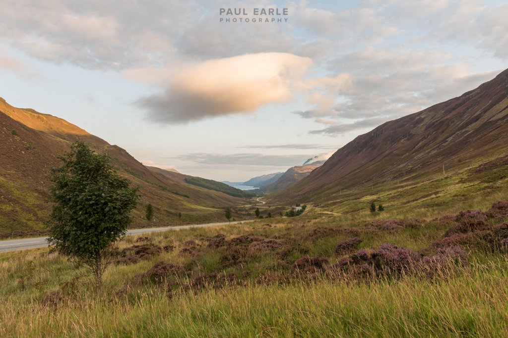
I left before sunrise again but not as early as the day before. On the route the sun was rising and presented some great opportunities to pull over and get some photos of the colours of that ‘best time of the day’ including seeing the tops of the distant mountain ranges picking up the sun as it rose. I also noticed the moon on its descent (slight obscurred by high cloud) after the ‘blue moon’ of the previous day.


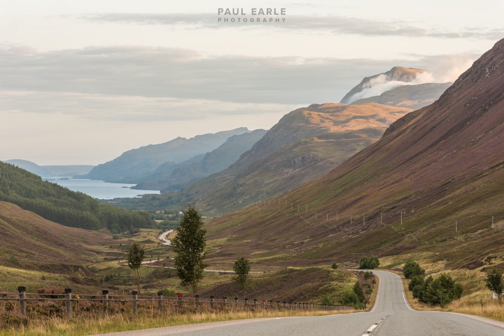
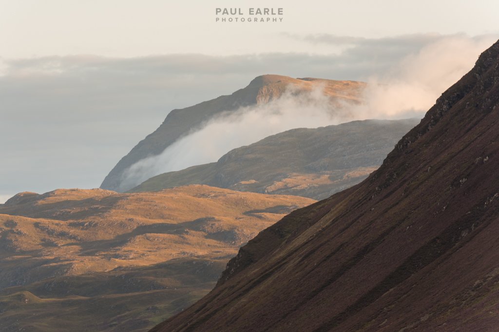
As I came over the top of Glen Docherty with the familiar view down to Kinlochewe, Slioch could be seen with cloud swirling around below the summit! There was hope for a clear top!
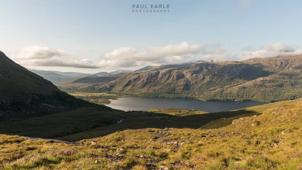
Parking up in the walkers car park and strapping camera harness to my front and rucksac to my back (about 12kg - which I would realise wasn’t going to help later!!!) I headed off the ~3mile path along a river and then follows the side of Loch Maree to the ascent route of the mountain. You eventually (just over an hour later) reach a bridge over a river and waterfalls where you turn right to start the first stages (of a number!) of the uphill journey.


After a long very tiring trek up the path, you eventually reach the Coire na Sleaghaich which is like a grass bowl and the views of the further climbs to the summit. At this point, I felt exhausted but pushed on with a plan to stop to rest the legs before the path up to the first shoulder that leads to a loch under the main body of the mountain.


The rest didn’t last very long as the midges soon found me, so it was back on with the rucksac and the climb up to the loch. There was a family camping by the loch that had come up the night before and told me of the great views of the sunset and moon rising. A perfect camping location!
The final challenge was ahead which involved navigating up the scree path as it zig zagged its way up the side of the mountain. The views on the way up were amazing, but I was not that keen on the thought of coming back down this path that was so loose under foot! In the photo below you can make out the tent by the loch. You started to realise how high you were at this point.
I continued up the path with a view of a ‘summit’ ahead of me thinking it was the trig point. By this stage I was totally shattered. - and the thought of the ‘summit’ urged me on with a rest within grasping distance! I was only to find however it was a false summit, with the sight of the trig point off in the distance involving a further ascent!
I pressed on and reached the trig point and started to absorb the views taking some photos as well, before collapsing on a rock to get some calories consumed and some rooibos tea from the flask!


The true summit was a way further on which I wandered over to with just the camera, leaving the rucksac at the trig point - realising now how much harder the walking had been made with carrying the camera gear. The first photo below is looking back from the true summit to the trig point on the left.


After resting for a while and getting a good selection of photos the decision was on the return route. There was a longer path back to the coire which involved a ridge and further climb as seen below. I don’t have an affinity for ridges after an unpleasant experience on Crib Goch (North Wales) many years ago, and although the ridge would have been fine, I decided to take the scree route back.

The descent was slow and steady and reaching the coire I started to realise how tired I was - with the prospect of another approximate 4.5 miles ahead of me.
The route down from the coire seemed to take a very long time during which I ran out of water before reaching the bridge. The views below are from the ascent but looking down the path back to the bridge.

Reaching the bridge, it was around about this point my Garmin watch, that had been recording the walk, starting alarming about the battery getting low. I didn’t want to lose the record, so it was a case of head down and brisk march back to the car - as much as my exhaustion levels by that point would allow. I ended up pausing and saving the record of the walk and restarted the tracking in case the battery survived to the car - which it did. By the time I reached the car, I was fully depleted almost in a daze. I don’t remember ever being so tired and was thankful I had brought some further water that I had left in the car, along with some fruit.
The Garmin tracking results gave me some indication of the reason for the tiredness! With over 2600 calories supposedly burnt and a total ascent of 1022m - I needed some food. LOL.
What a day - the views made it all worthwhile and the weather had been perfect. Even the breeze/wind levels had been sufficient to keep the midges away except for the one point below the loch.
A stunning mountain, with stunning views!
